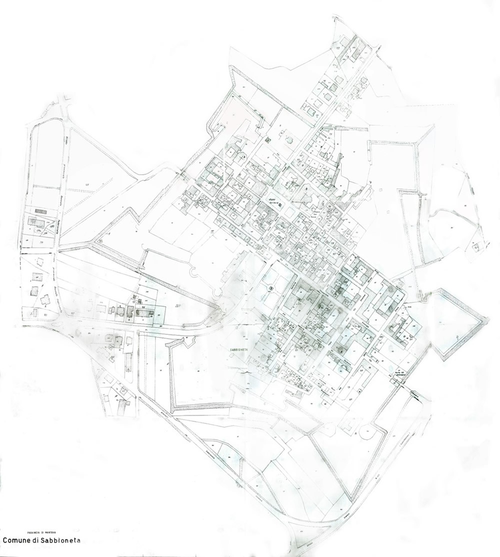
The historical cadastres, starting from the maps of a late Theresian (1774), restore with greater geometric and topographical precision the design of the fortifications established between the seventeenth and eighteenth centuries by the military cartographies. Further evidence is provided by a cadastre from the early twentieth century, while a cadastre from 1970 illustrates a situation similar to the present day with regard to the walls and the course of the moat following the demolitions that occurred in the twenties.
The Theresian Cadastre (1774)
ASMn FONDO CATASTO - sheets 11 and 12 - First folder Theresian cadastre 1774, sheets X and XI, "Survey made by Surveyor Bartolomeo Villa from 11 July to 6 September 1774, by surveyor Pietro Molardi from 12 October to 6 September south. By surveyor Carlo Brunelli from 15 October to 6 September south. And by the surveyor Francesco Bronzi from the day 26 October the day ... November 1774"
The city is represented complete with roads and outlines of buildings, even if the walls are represented as simple lines.
The city walls are surrounded by a large moat, which also encloses the castle.
Inside the moat, there are two ravelins in front of the doors and a lunette between the bastions of San Giorgio and San Giovanni.
The external embankments are very articulated and reinforced at various points by counterguards.
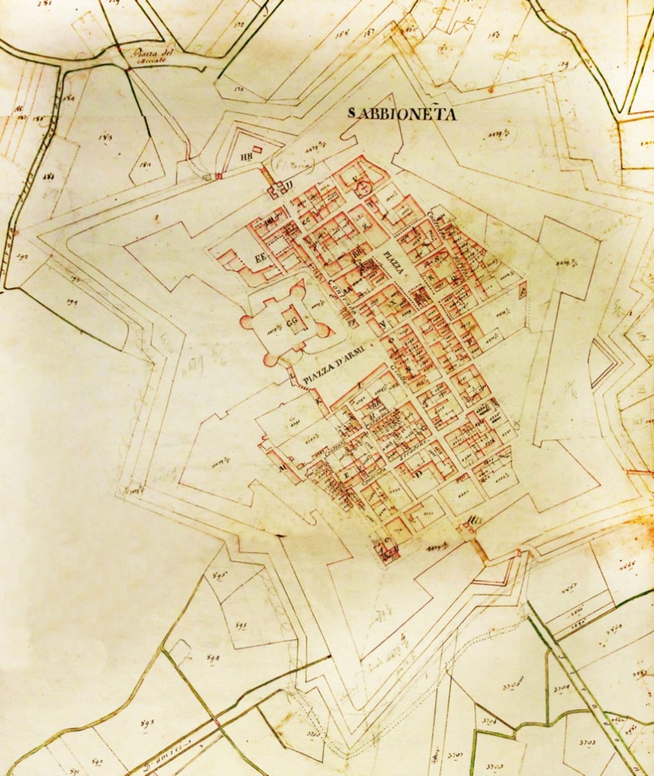
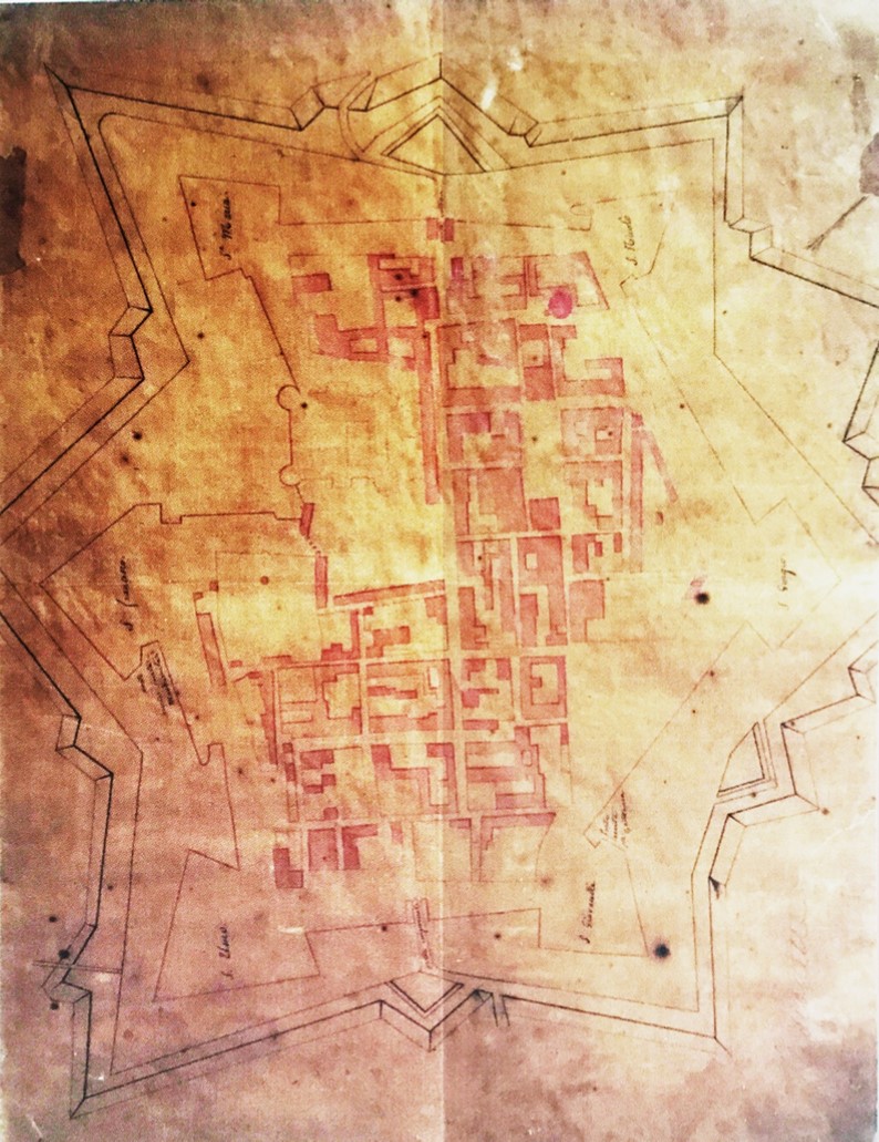
Undated post Theresian cadastre
ASMn Maps and models of various origins - roll 526, CITY OF SABIONETA – Sabbioneta city plan, similar to the cadastral, with a note from engineer A. G. Noè dated September 1, 1842 about the unreliability of the map for census purposes.
The map is from before the demolition of the castle in 1794. The drawing takes up where the Theresian Cadastre left off, but at the bottom it shows the original facade of Porta Imperiale, identical to that of Porta Vittoria and with references to the Porta di San Zeno (San Zeno gate) in Verona, by Paolo Sanmicheli. You can also see the two ravelins on the other side of the gates.
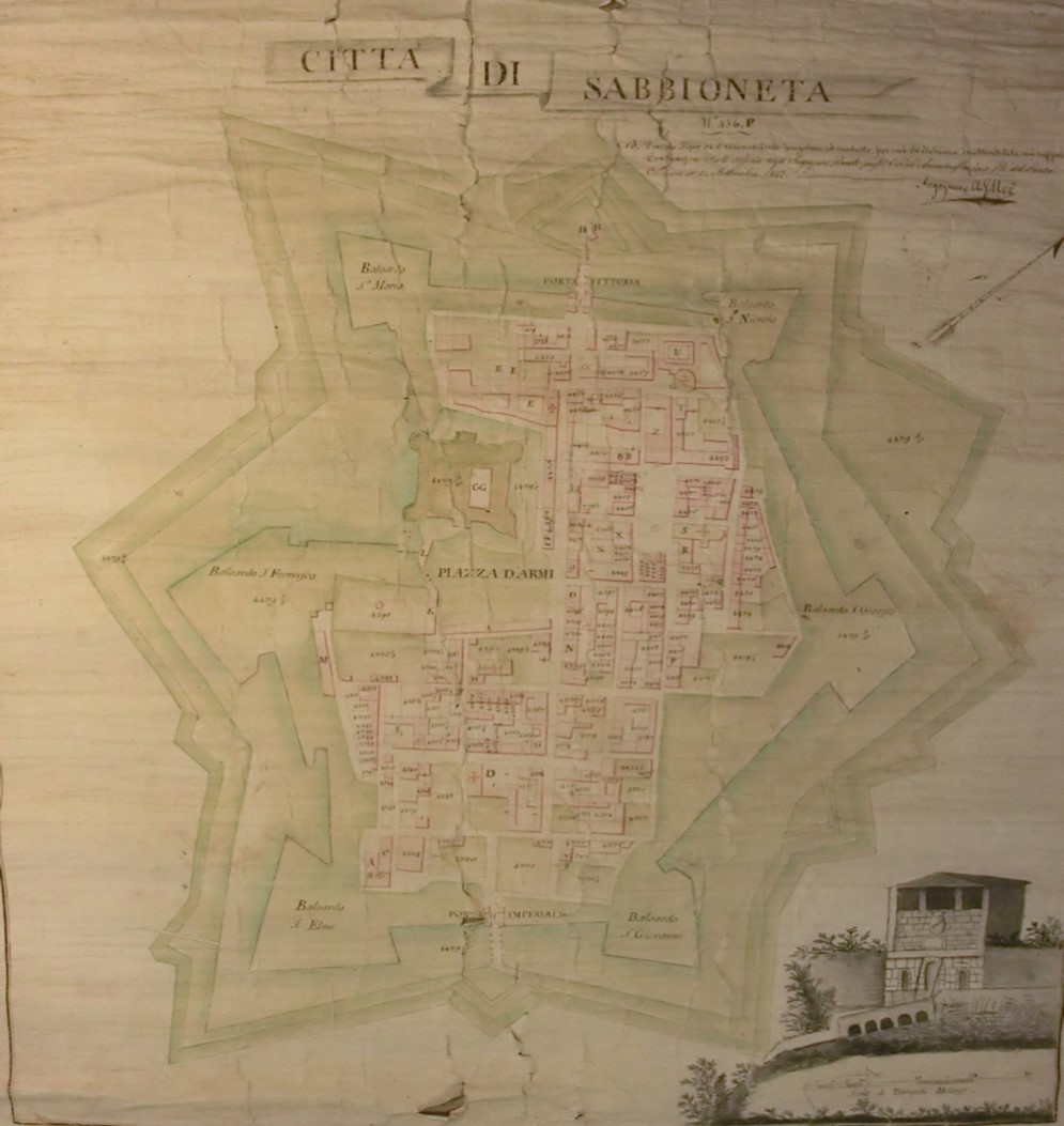
Undated post Theresian cadastre
ASMn FONDO CATASTO - roll 479 - no date, similar to 450, entitled "Sabbioneta con Ponteterra, villa Motta, Breda Cisoni e Commessaggio".
The map shows the drawing of the Theresian Cadastre.
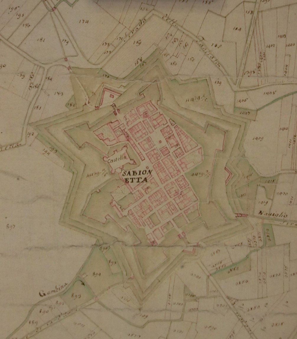
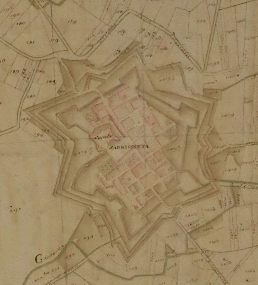
Undated post Theresian cadastre
Map of Sabbioneta, Sabbioneta, Vittorio Rossi Collection.
It is a map of the Theresian period, which can be dated between 1774 and 1786. It represents the buildings inside the walls (including the castle) and the fortified structures inside (walls) and outside (embankments), highlighting the slopes with a handwriting style that emphasizes the survey. In addition to both ravelins, there is a lunette between the bastions of San Giorgio and San Giovanni.
Undated post Theresian cadastre
ASMn FONDO CATASTO - roll 480 - contains an annotation dated 3 January 1810 with the title "Territorio di Sabbioneta con Ponteterra, villa Pasquale, Breda Cisoni e Commessaggio di là" Provincia di Mantova, Dis. III, n° 4 Sabbioneta ed Uniti.
It is a simplified map that recreates the municipal territory as a union framework. The representation of Sabbioneta is summarized, in particular by merging the buildings inside the same blocks, but still entirely consistent with the Theresian cadastre with regard to fortifications, moat and external layout.
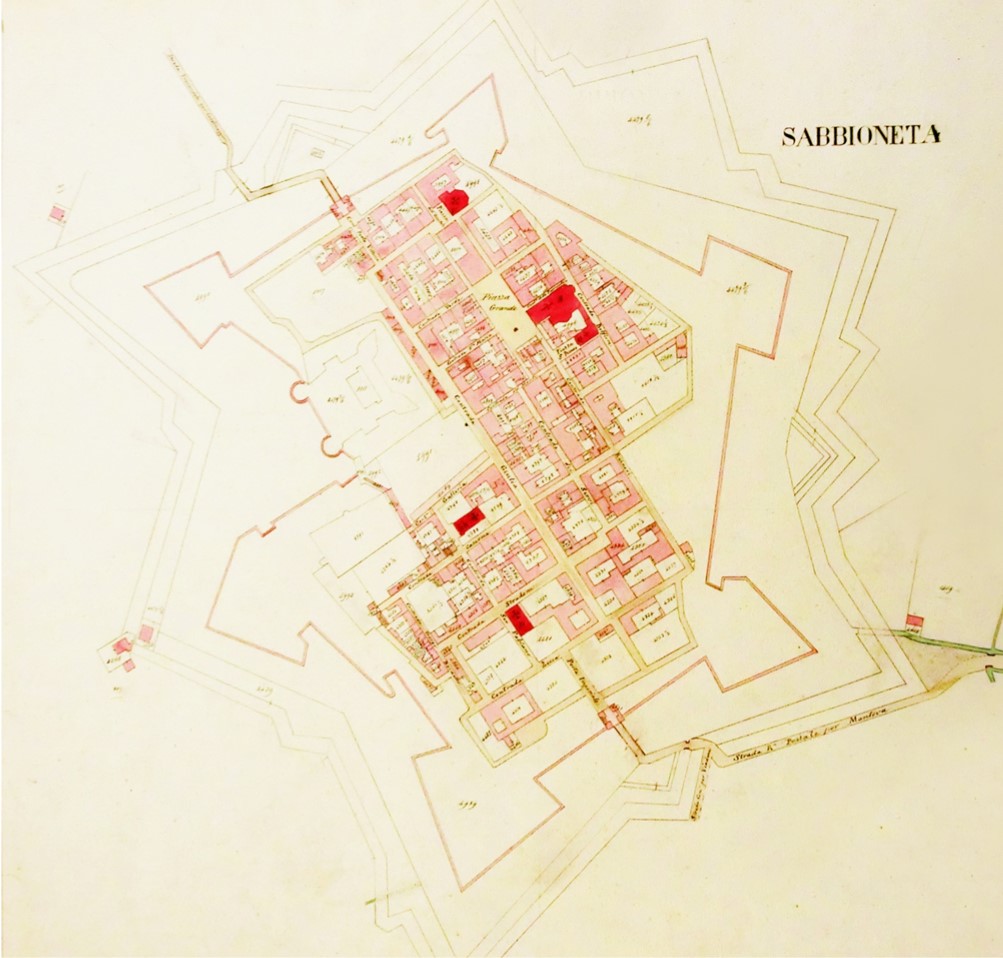
19th century cadastre (1854)
ASMn FONDO CATASTO - envelope 25 - Map of census municipalities 1854, sheet 4, "Attached to the map of census municipality of Sabbioneta ed Uniti - District of Viadana - Province of Mantua. Carried out in the year 1854 because of the renewal of the estimate of the buildings.
The city, the walls and the external embankments follow the conformation represented in the Theresian Cadastre, with the only significant exception of the castle, identified as an outline left uncoloured as it was demolished. The fortifications are depicted not with simple lines, but through the highlighting of the thickness of the wall covering.
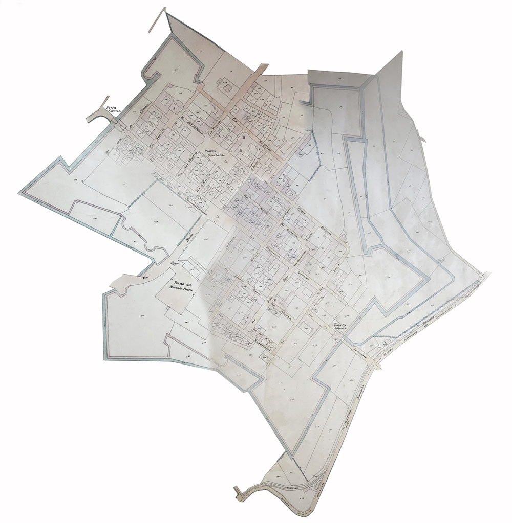
Post-unification land registry (1923-1934)
ASMn OFFICE OF DIRECT TAXES FUND OF VIADANA - Folder 175. Sabbioneta - Survey of the late nineteenth century, updated to include the early decades of the twentieth century.
Due to the updates made in the first decades of the twentieth century, the cadastral planimetry already illustrates the opening of the breaches to the south-west and north-east of the walls. However, there are some elements that recall the original design that was gradually destroyed, with particular reference to the moat, still attached to the bastion of San Nicola and characterized by parallel channels along the site of the ancient river bed (outside the bastion of San Giovanni, the Bresciani ramparts and the bastion of San Giorgio). There are also channels inside the embankments, at the foot of the escarpments.
1956 Cadastre
ASMn OFFICE OF DIRECT TAXES FUND OF VIADANA— Folder 176. Sabbioneta - Survey around 1956.
The cadastre of 1956 shows a similar picture to that documented in the hydraulic redevelopment project of 1968, with the two openings to the north-east and south-west further consolidated the moat, which was re-outlined as a result. Even if the external fortifications already appear to be all destroyed, the star-shape that was spreading in the surrounding territory is still partially legible in the structure of the farm estates round the walls.
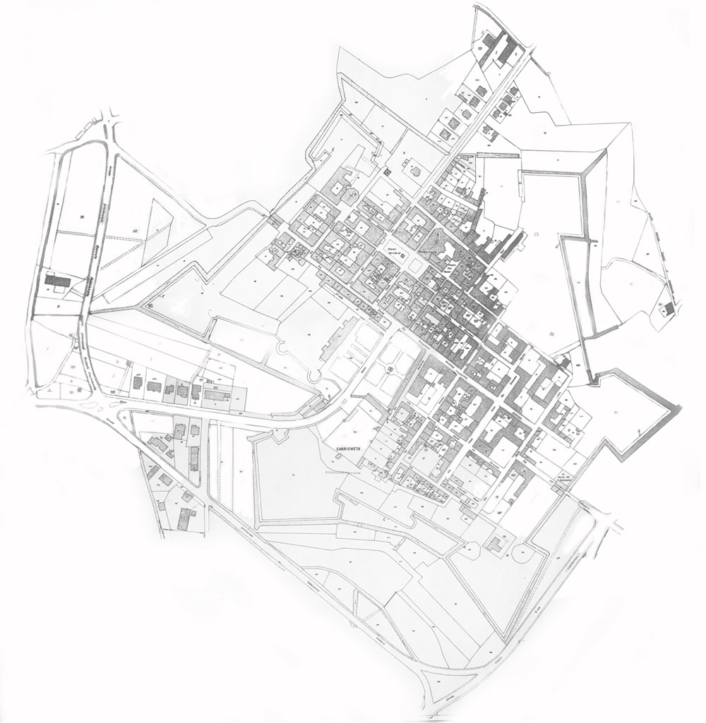
1970 Cadastre
Archive of the Municipality of Sabbioneta, 1940 Cadastre
The 1970 cadastre does not provide any further information compared to 1956, representing in fact a picture similar to the current one. To the north-east of the walls there are still elements of the hydraulic system, which in the following decades were further simplified.
